(Posted Wednesday 4/8 1pm)
We have some pretty interesting weather occurring this afternoon...I'll break it down below because there's a lot going on.
1) First image shows the latest radar image. You can see an MCS (mesoscale convective system) which developed in the midwest along the temperature gradient and is now racing to the southeast. This wasn't picked up very well at all by any of the models....no surprise there with all the different little pieces of energy floating around. This MCS has a history of producing hail (golf ball size) and severe winds (60-70 mph) across portions of Indiana and Ohio.
2) The second image shows the latest HRRR (High Resolution Rapid Refresh) model for later this evening. You can see that it maintains the MCS into western Virginia...right through the Shenandoah Valley. I don't think it's handling it correctly for reasons explained below.
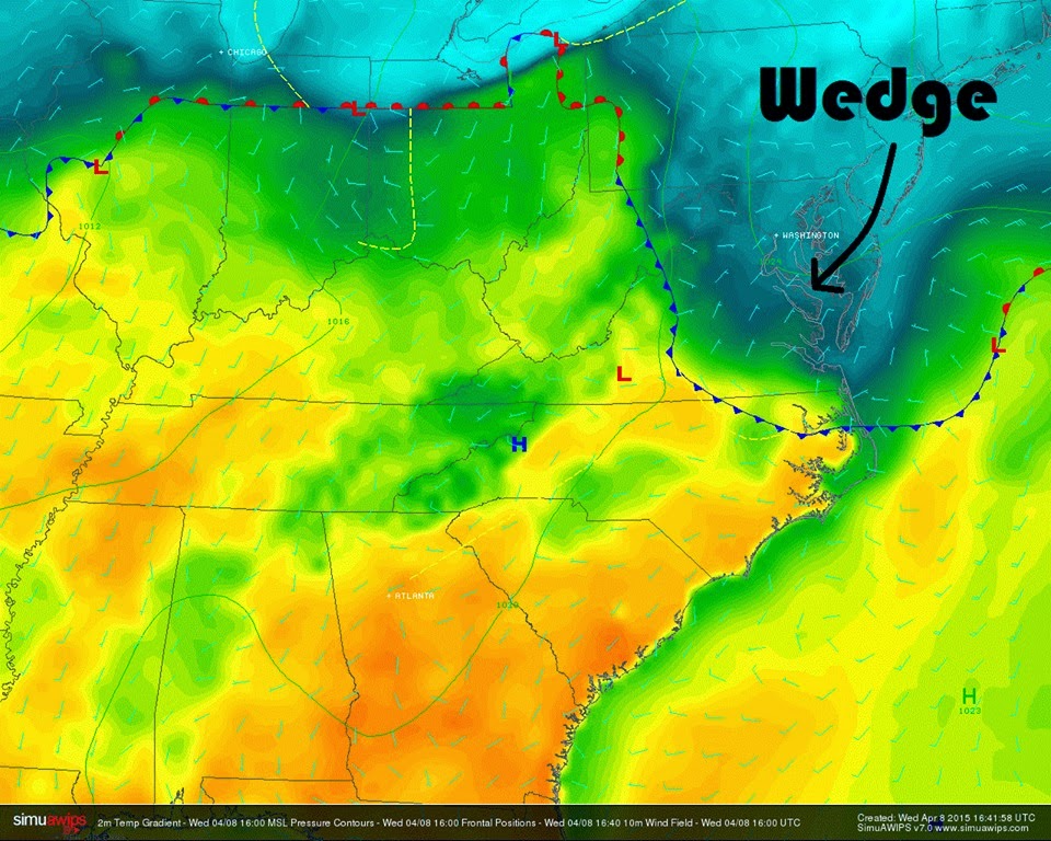
3) The third image are the current temperatures and frontal features. You can see a back door cold front has pushed southwest across central Virginia as high pressure wedges down the east coast. This is actually a good bit earlier than I expected (I figured it would arrive later tonight into tomorrow). Temperatures (and instability) are drastically different depending on which side of the front you are....40s and 50s north....60s and 70s south.
4) The fourth image is a probability of MCS maintenance chart. Because of the wedge working in, these values decrease significantly the further north you go. This means that once the MCS hits the wedge, we should see significant weakening. The exception may be across areas of southwest VA that are still under the influence of very warm, moist unstable air.
That's where things stand now...will be keeping an eye on it the rest of the afternoon and evening.


No comments:
Post a Comment