First off, thanks to everyone that followed along here both during and the days leading up to the storm. I appreciate all the reports and pictures that came in on the Facebook page. I know many of you enjoy tracking snowstorms as much as I do. Others of you hate snow but want to know what it's going to do outside regardless. Either way, thanks for following along and enjoying our wild Virginia weather ride.
Update on the Storm
The last piece of upper level energy is moving south and east, providing a quick burst of snow for much of the south central and south east VA. This will continue to move out over the next few hours before tapering off northwest to southeast. These areas may pick up an additional quick coating to an inch or two.

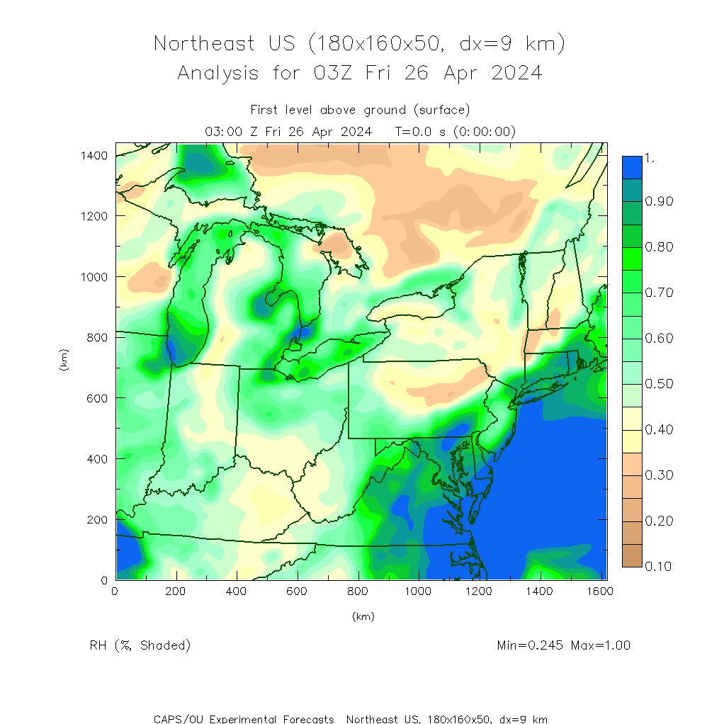
There's a lot of cold, dry air surging south out of Canada. The map below shows current relative humidity values. There's a sharp cutoff between moist and dry air, with the latter quickly working its way southward. One of the reasons most areas saw closer to the lower end of my projected totals (final call map- http://noapologyvameteorology.blogspot.com/2014/03/final-call.html) was because once the cold air arrived and it was cold enough to snow, a lot of the best moisture was gone. The cold front didn't only push out the warm temperatures, but also most of the precipitation.
Frigid Temperatures Tonight
This dry air will allow skies to clear out late. Below is the Canadian cloud model for early Tuesday morning. You can see most of the area will be under clear skies. This, along with fresh snow pack, will really allow temperatures to plummet.

Latest model guidance is still suggesting that we see widespread single digits and teens with a few areas likely going below zero. Many will break all time daily record lows. With slushy or wet roadways, be cautious of any refreeze overnight into tomorrow morning. I'll post the final snowfall totals map once it becomes available.
 |
| 18z nam lows for Tuesday AM |
No comments:
Post a Comment