I was looking for an analog for this upcoming storm and the closest I could find was the March 1-2 storm of 2009. This is by no means a perfect analog (of course there is never a perfect analog), but there are some pretty striking similarities. A lot of the information on this 3/1-3/2 event from '09 came from Ray's Winter Storm Archive (http://www.raymondcmartinjr.com/weather/2009/02-Mar-09.html), a great site to use to look up past winter storms. Everything highlighted in tan is from my the analog event, followed by comparison to what we have coming up mid next week.
Synoptic Discussion (From Ray's Winter Storm Archive) for 3/1-3/2 2009 event
A cold front moved through New Jersey during the evening of the 27th and early morning of the 28th. The front then stalled over the Southeast during the day on the 28th as a low pressure developed over the lower Mississippi Valley. The low moved eastward into Georgia by midnight on the 1st, then turned northeast and crossed the Carolinas during the day on the 1st. By the morning of the 2nd, the low was due east of New Jersey, and by midnight on the 3rd it reached the Canadian Maritimes.
A cold front moved through New Jersey during the evening of the 27th and early morning of the 28th. The front then stalled over the Southeast during the day on the 28th as a low pressure developed over the lower Mississippi Valley. The low moved eastward into Georgia by midnight on the 1st, then turned northeast and crossed the Carolinas during the day on the 1st. By the morning of the 2nd, the low was due east of New Jersey, and by midnight on the 3rd it reached the Canadian Maritimes.
Synoptic Discussion from the National Weather Service in Blacksburg for this Coming Week
COLD FRONT OVER THE OHIO VALLEY WILL CROSS
THE MID ATLANTIC REGION TONIGHT...SOON FOLLOWED BY ANOTHER UPPER
LEVEL DISTURBANCE ON MONDAY. THE COLD FRONT IS EXPECTED TO STALL
OVER THE GULF COASTAL STATES TUESDAY AND THEN BECOME THE FOCUS OF
AN AREA OF LOW PRESSURE WHICH IS FORECAST TO DEVELOP OVER
TEXAS...AND THEN MOVE NORTHEAST TOWARD THE MID ATLANTIC COAST
WEDNESDAY INTO THURSDAY.
500 mb map for 3/2/09 6z
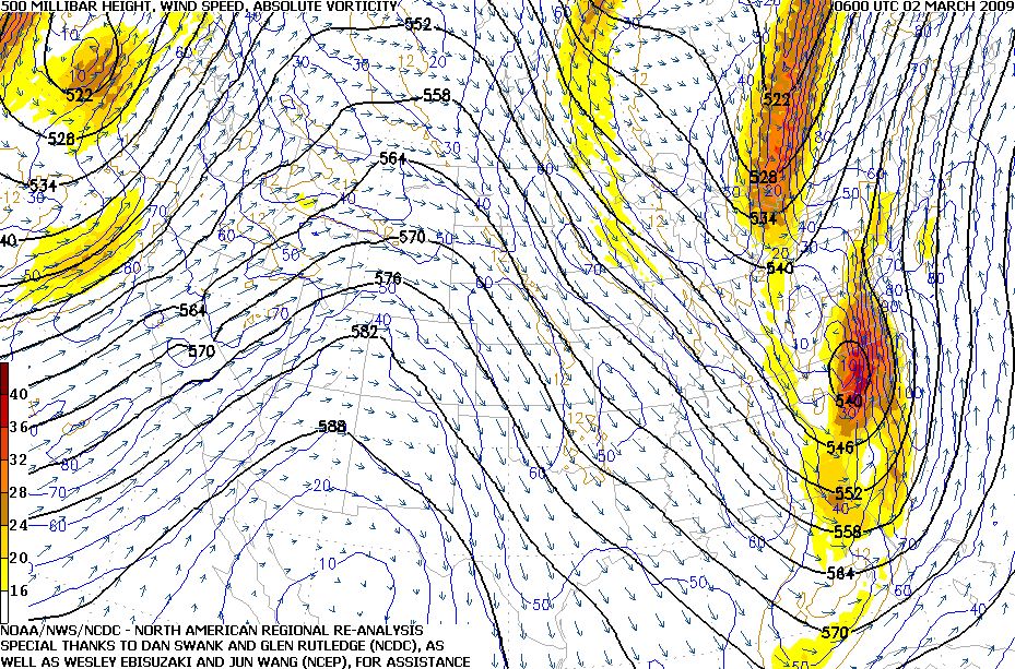
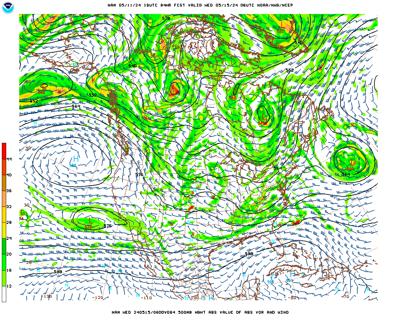
Now here's the 18z nam 500 mb forecast for this Thursday at 6z. I will note that one big difference with this coming storm is that we have a much flatter ridge over the west. This prevents the trough over the east from digging quite as much, but as you'll see below, surface pressure reflection ends up pretty close to what's in the forecast.
 |
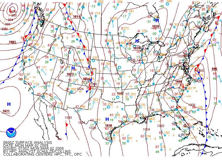
Surface Pressure Map from 0300Z 02 March 2009 (10PM EST 01 March 2009)
The Weather Prediction Center's Day 4 Fronts/Pressures Forecast for Thursday.

With the comparisons out of the way, here's the total snowfall from that Early March 2009 system. I think we see a similarly oriented stripe of snow with these kinds of amounts next week---adjusted east or west depending on the exact track of the low. First guess map will be out Monday afternoon.
 |
| Snow Totals March 1-2, 2009 |
No comments:
Post a Comment