(Friday 7/10 pm)
A Flash Flood Watch has been issued for parts of the central Shenandoah Valley through Saturday afternoon...

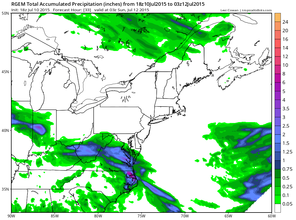
A wave of low pressure currently over the Ohio Valley will ride east and eventually east-south-east into the area overnight. Heaviest rain in the Valley will fall between midnight and 10 am Saturday before tapering off in the afternoon.

There will be a skinny area that sees 1-2+" of rain. It's tough to pinpoint exactly where this sets up but I the RGEM below gives a general idea. This amount of rainfall on top of saturated soils will cause at least some concern for flash flooding. Much nicer weather Sunday to end the weekend.
No comments:
Post a Comment