As today's coastal storm departs, a clipper system diving southeast out of the northern plains will bring another shot of snow late tonight into the day tomorrow. Below is the current 500 mb map showing this piece of energy currently over the Missouri Valley. This track is important since the area just to the north of the 500 mb energy is where lift is maximized and most precipitation usually occurs.
 |
| current 500 mb map (CAPS/OU) |
Current radar shows the band of light to moderate rain and snow associated with this currently over parts of Kentucky and Tennessee. It will make it into far southwestern VA shortly after midnight before quickly moving east across the southern portion of the state throughout the day.
 |
| Current Radar (NWS) |
I like to look at the SREF (Short Range Ensemble Forecasting) members when it comes to forecasting clippers to try to get a handle on who sees precipitation. It's important to remember that clippers usually don't have a lot of moisture to work with and a lot ends up squeezed out on the western facing slopes as flow is forced up over the mountains. Although this clipper isn't all that strong, it won't have to fight extremely dry air in front of it. Still, marginal temperatures and not much precipitation associated with it will keep this a non-event for most.
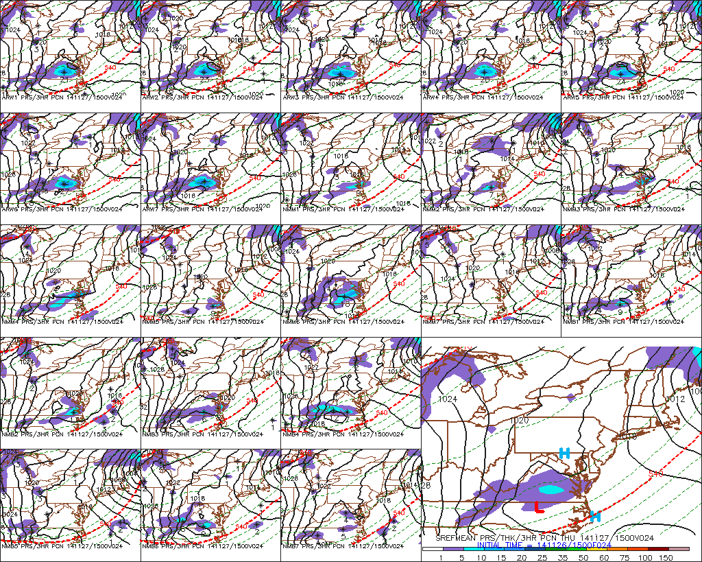 |
| SREF Members 10am Thursday (PSU E-WALL) |
Here's how I see things working out..generally a coating to an inch across portions of SW VA, although some higher elevations above 3,000 feet may see a couple inches out of this. If you live across in the piedmont/central Virginia, dont be surprised to see a few flakes mix in with light showers at times tomorrow. This certainly won't be a huge deal but very well may be our last snow-threat for awhile.

No comments:
Post a Comment