Below are two images; image on the left is the 18z rgem (high resolution model Canadian) forecasted temperatures for 7pm and the right are the latest temperatures across the area. The cold front is stretched from just north of Beckley to Charlottesville to Richmond and appears to be right on if not slightly ahead of schedule.

I still like how consistent this model has remained with amounts. Here's the latest 18z run snowfall which looks very similar to its past 3 runs and still carries the most weight with my forecast.

Below are two short range models for tomorrow morning at 7am. They both have an area of very heavy snow across the central and northern Shenandoah Valley/stretch east across the mountains to DC/Fredericksburg. 1-2" per hour snowfall rates will be possible. It's going to be a rough morning commute for these areas as road conditions go downhill fast.


I'll try to have an update sometime later tonight. Here's my forecast from earlier:
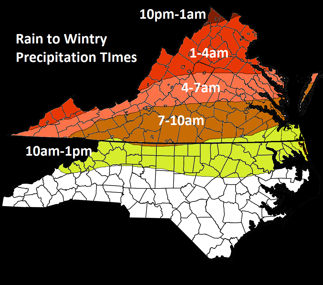
Expected Changeover times:
My Final Call:

No comments:
Post a Comment