Radar 948AM
MCS (Mesoscale Convective System) shown over Indiana/Ohio moving rapid South-South-East. Notice Storms firing acorss south central PA/Central Maryland-This is where our forecast ended up being wrong.

Radar 238pm
Notice how storms blew up across northern VA...but the mcs fell apart as it hit the mountains. Never enough upper level forcing/along with cloud debri from earlier morning convection choked it out.

Radar 430
Another strong MCS forms in NC..mainly a rain/thunder event over most of va with the exception of an isolated severe cell that fired in SE va..just north of Petersburg before tracking east into around Williamsburg.


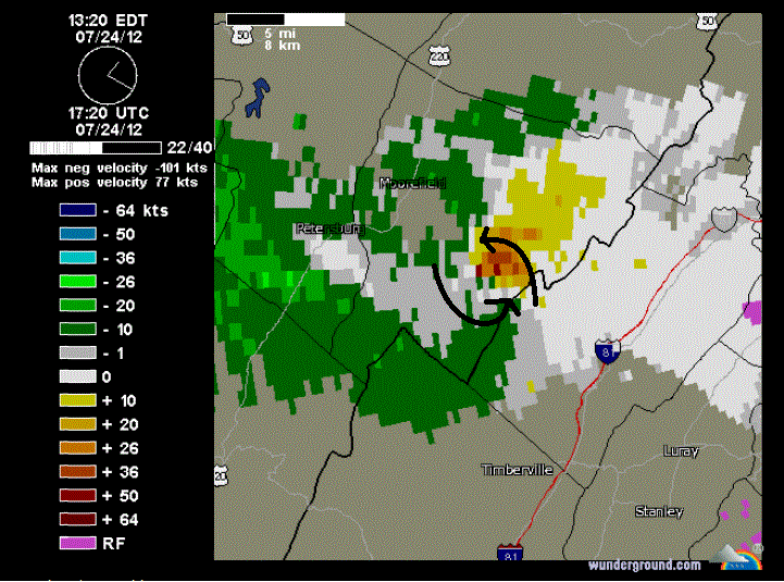
No tornado was ever reported with this cell...but it did show a great bit of rotation. Here's a velocity image of the storm at the same time as the radar posted above. This is a typical tornado signature definitely showing rotation.
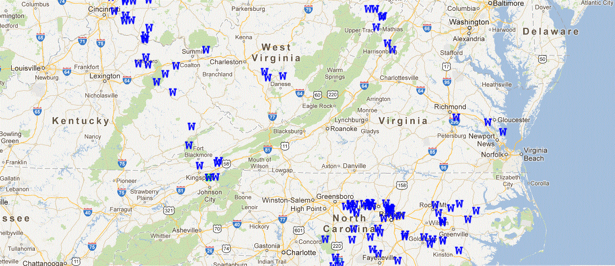
Storm Report Map From SPC
Reports came in from 3 general areas. 1)SW VA with decaying MCS 2)northern Shenandoah valley with storm shown above 3)SE VA with isolated cell that developed out ahead of main cluster-Overall not a big severe weather day here in Virginia
One welcome surprise with this was the rainfall...Many locations picked up over 1"...especially across SW va and the central/lower Shenandoah valley.
No comments:
Post a Comment